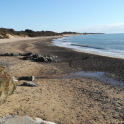
And so, we come to the start of the journey around Howth. It would be a terrible injustice to veil this stage in Beckett-like prose or a poem, as a full picture is needed.
In my 53 years on the planet, most of which as a Dubliner, I had never before considered the wilds of Howth peninsula, and I shouldn’t wonder than a majority of the other million and a half Dubliners would only have a cursory knowledge of the coastal paths of South Howth. They really are a wonder though, as all will unfold here.
Previously inspecting Google Maps to a point, I had assumed that there was a coastal road heading east to west and without the need to clarify for the planning of the previous stage, I didn’t pursue the geography. Then on the last day out, I learned that the coast road stops a little after the dinghy club at Sutton and the road doesn’t then meet the sea until the town of Howth, around the other side of the headland mass, which is 11 kilometres away.
None of this bears any relevance until we go to consider that we are now about to embark on a series of stages with little or no access to landing, due to cliffs and a general lack of beaches. It must have been our stoic intransigence developed through the five years we have been doing this that lead us to just plough on with our intentions.
By way of insurance, I carried out a reconnaissance mission the previous day with my daughter. With a suitable amount of google mapping, I knew a basic vantage point with which to park the car and follow the coastal paths to assess what’s what. Looking ahead we first made our way to a part of the cliffs that overlooked a beach called ‘A Tiny Hidden Beach’. We looked down a 100 metre drop and the fearful old pensioner in me was saying to myself, ‘may we should just leave it’. By way of hoping to find a way out, I asked my daughter will we climb the (steep) path down to the beach? I got a non-committal ‘I don’t mind’, which wasn’t the answer I was hoping for.
And so, we find ourselves descending the most precarious and winding steps. Some stone, some brick, some muck. I kept thinking that being macho isn’t a very intellectual disposition, but the sense of relief and achievement when we landed on the beach. There were many other people there, predominately tourists, who had made the descent to this stoney cove, including a golden retriever. We took some photos and a video to show off when we got home.
My concern really for this recon was to establish an exit point for the immediate swim, so we got going again. The return ascent didn’t seem as daunting, probably because we weren’t looking down, but our hearts were racing, and our legs were jelly when we got back to the top of the cliff. We had to sit down. Even after five minutes when we decided to get going, our legs felt very weak. I kept asking my daughter and she kept confirming this. I knew I was asking just to let her know that I acknowledged her fatigue, even though we kept walking.
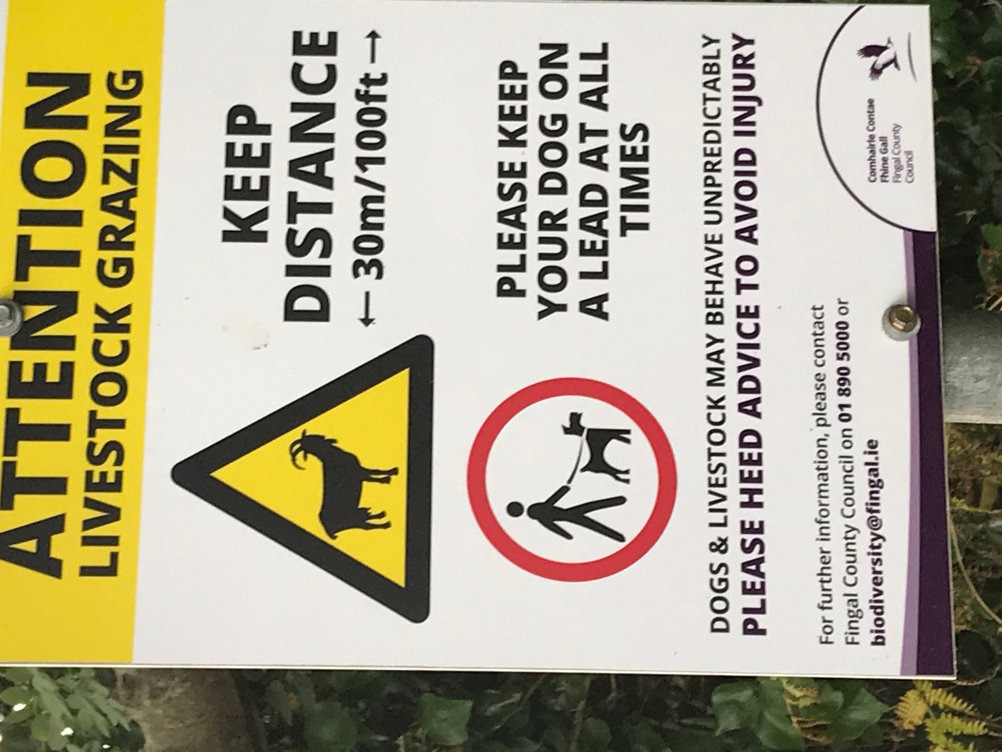
We now followed the coastal path from the lighthouse, west. It was like walking through a trail in deepest darkest Brazil, that was interspersed with the back gates of possibly the most expensive housing in Dublin. People passed us occasionally, but it was mostly young men possibly in the narcotic business, or certainly the recreational aspect of it. We came across some signage warning of wild goats. I had to take a photo due to the absurdity of wild goats being in suburban Dublin.

When we eventually came upon a path down to another beach that would be a little over than three kilometres from the start point back in Sutton, we tested the descent to get an understanding of what’s involved, even though I could see that the waters were littered with a dangerous archipelago of rockery. Our legs and feet were so tired that we really need to get the 2 kilometres back to the car and sit down so I made the decision that we had at least this beach that we could exit by, if not, one that Google maps reported about 500 metres further west. About 200 metres back I noticed a turn which would bring us to a suitable parking space.
We went home.
The next morning, Niall and I met at the layby at the waterfront in Sutton, we both had cars on account of the fact, that I reckoned we were not fit to attempt the hills of Howth on bicycles and still swim 3 km. We got into our suits and drove both cars to the residential cul-de-sac I discovered through the previous day’s scouting, leaving my car there and driving back to the layby in Niall’s car. As Niall and I both own the same type of car, it was like ‘Night of the Priuses (in the morning)’ in the back roads of Howth. We had prepared well as high tide was 11:15 and we wanted to be swimming for the hour and a half preceding that. We were entering the water at somewhere around 10.
We both noted the windiness which again we overlooked with the previously mentioned stoicism. After a few strokes in the water, I was confronted with a successive series of mouthfuls of seawater due to the choppiness. I said to Niall, ‘This was looking like it was going to be a long day’. Thankfully he didn’t engage. We plodded on and Niall was quickly leaving me behind. His fitness levels have been far superior to mine in recent years, especially this year.
I kept getting gagging mouthfuls of sea due to the turbulence, and I knew that I had made my bed in terms of embarking on this swim. When we got the first 400 metres to the dinghy club, Niall stopped ahead of me just long enough for me to catch up and tell me that ‘we are now going past the point of no return’. I knew this already, but I didn’t want to hear it. No mind. He was gone on ahead again. We could see a Martello Tower up ahead at a headland, and from memory this was the 1 kilometre mark. It took an age to get there, and this was probably due to the parallax that it was further away than appeared. As an exercise after I got home, I re-checked it’s distance and it was closer to the halfway distance of 1.5 kilometres that the third-way point of 1 kilometre.
Niall eventually stopped and allowed me to catch up with him at the tower. I had come up with a theory that the northerly flow of the rising tide divided at this point and that the push against us would transform into a propulsion in favour of our course. Certainly, the coastal rocks seemed to start moving past us at a more reassuring rate. I surmised that the first of our possible exit points might be around the other side of the next headland. The sun was shining. The gobfuls of brine hadn’t defeated me and I got by with the reassurance that at least I was halfway. Niall was beginning to slow up to my paltry pace. I was a bit wary of potential currents off headlands, so I told him, ‘If you see the light house around the next headland, take a sharp left into the shore’. The lack of having ever navigated these waters filled us with trepidation. I had completely forgotten the previous years where all sorts of uncharted waters and beaches were negotiated.
We seemed to be moving fast now although I was stopping and treading water every few minutes. We came around a headland and a beach presented itself. We debated whether this was the beach we thought we could decamp to easiest. We decide to get out and rest and assess. It was a rocky beach, which is always going to be sore on my already sore feet. The back of the beach had fencing which was quite weather beaten and I didn’t recollect this vista from Google maps so after ten minutes rest and drinking bottled fresh water, we decided it wasn’t our beach. We prepped up and got back in the water, unsure what was left of our journey. The choppy water was now quite calm. The next headland was about two hundred metres away, and hopefully when we got to it, we could establish our bearings. We were tired by this stage but not demoralised, though I can’t speak for what was going through Niall’s head. He had put all his faith in my orienteering skills.
And then we got to the next headland and lo and behold, the lighthouse was across the bay. Alleluia. It didn’t seem familiar to the previous day’s vista, because it was from a completely different angle, so we were now into fight or flight mode. We paddled inwards but couldn’t see the landing beach. I looked up, and I could see that there was a trodden path up a smaller cliff. Maybe here. We paddled a bit more, a lethargy of breaststroke. A very small cove at the bottom of the trodden path. I needed to put an end to this fatigue so I said to Niall, ‘This will probably work’ or words to that effect.
We beached, though the cove was a deposit of large copper-coloured stones which looked Mediterranean in the sunshine. Niall held his hand out for the customary shaking of hands, but it took me a minute or two to get the three metres over the wet stones to get to him. This wasn’t a planned exit and the path down the cliff face stopped at a rock roughly three metres above the level of the shore. There was a large boulder that had ingresses in it in such a way as to suggest that this was the traditional route out of here. I had noticed that there was a cliff walker showing interest or concern in us as we paddled ashore. And possibly, rightly so as these weren’t swimming waters. When I scaled up to the bottom of the path down the face, I could see him again, he gave me the thumbs up question, which I acknowledged with a thumbs up. All was well.
At the top of the cliff, it still wasn’t evident where it was that I had planned to exit the previous day. We walked the coastal path in an eastern direction, there was no visibility of the coast below due to the abundance of blackberry bushes lining the path. Niall being a connoisseur of blackberries, had to stop. His expertise suggested another week or two before they ripen. After another 100 metres we came across the path I discovered the previous day. At a little over ten metres beyond that we had an elevated vantage point where we could now see the intended destination and that it was literally 20 metres beyond where we ended up exiting.
All is well that ends well, and I now am quite familiar with the south side of the Howth peninsula.
